Assisi Maps and Orientation
(Assisi, Umbria, Italy)
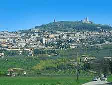
The medieval town of Assisi is located in central Italy, within the region of Umbria and the Perugia province. Assisi lies next to Mount Subasio and the Apennine mountains, and is home to a population rapidly approaching 30,000 people.
Relatively close to the cities of
Rome in Italy's Lazio region and
Florence in Tuscany, Assisi enjoys a hilltop situation and is home to no less than two castles. Due to its elevated setting, subsequently the town offers some truly outstanding, scenic views.
Maps and Orientation of the Town
During the busy tourist season in the summer, Assisi can become busy, particularly at the weekends. However, if you choose to explore early in the morning, the streets are peaceful and quite empty, allowing you to fully appreciate the stone architecture to its best advantage.
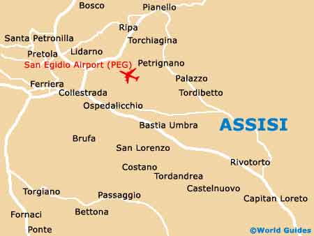
The very heart of Assisi is home to the spreading Piazza del Comune and this square is close to the main restaurants and sights, many of which line the Corso Mazzini. Directly north-west of the Piazza del Comune, the Via Portica and also the Via San Paolo offer a direct route to the Basilica di San Francesco. If you require maps of the city, Assisi has a number of different tourist offices, situated next to the Porta Nuova and also on the Piazza del Comune itself.
- Amelia - 105 km / 65 miles (one hour and 30 minutes, south)
- Ancona - 127 km / 79 miles (two hours, north-east)
- Arezzo - 110 km / 68 miles (one hour and 35 minutes, north-west)
- Fano - 126 km / 78 miles (two hours, north)
- Florence (Firenze) - 171 km / 106 miles (two hours and 15 minutes, north-west)
- Foligno - 21 km / 13 miles (28 minutes, south)
- Gubbio - 50 km / 31 miles (55 minutes, north)
- Montepulciano - 88 km / 55 miles (one hour and 20 minutes, west)
- Monterotondo - 167 km / 104 miles (two hours and 20 minutes, south)
- Perugia - 24 km / 15 miles (35 minutes, west)
- Pesaro - 136 km / 85 miles (two hours and 10 minutes, north)
- Ravenna - 198 km / 123 miles (two hours and 45 minutes, north)
- Rome (Roma) - 195 km / 121 miles (two hours and 35 minutes, south)
- San Gimignano - 169 km / 105 miles (two hours and 25 minutes, north-west)
- Spello - 14 km / 9 miles (20 minutes, south)
- Spoleto - 46 km / 29 miles (45 minutes, south)
- Terni - 78 km / 48 miles (one hour and 10 minutes, south)
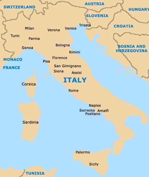
Map of Italy
Map of Assisi